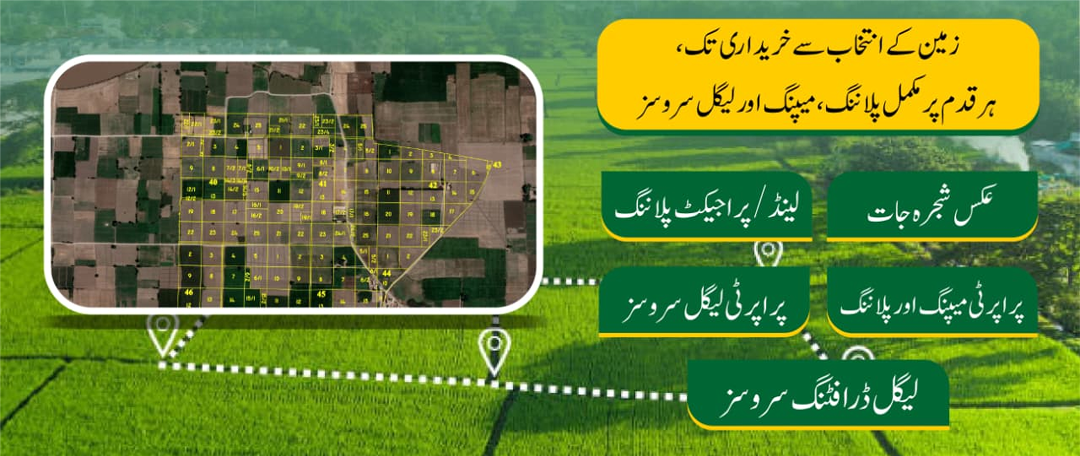
Scan & Plan with Precision
Five specialised services — each combining field expertise with modern mapping technology for landowners across Punjab.
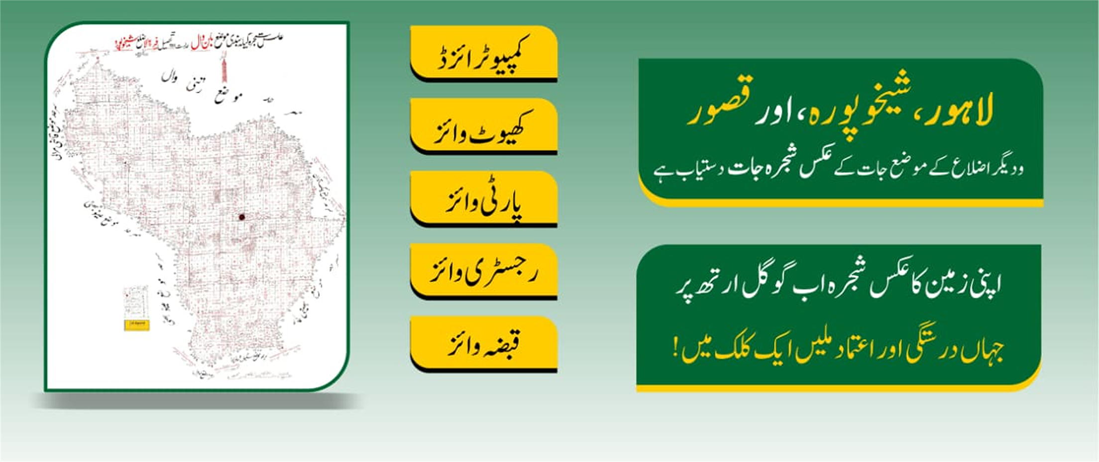
 Aks Shajra Jaat01
Land Records
Computerised · Google Earth
ShajraMaps
Our digitised shajra maps place every land parcel on Google Earth with pinpoint accuracy — khasra-wise, party-wise, registry-wise and qabza-wise records for Lahore, Sheikhupura, Kasur and surrounding districts.
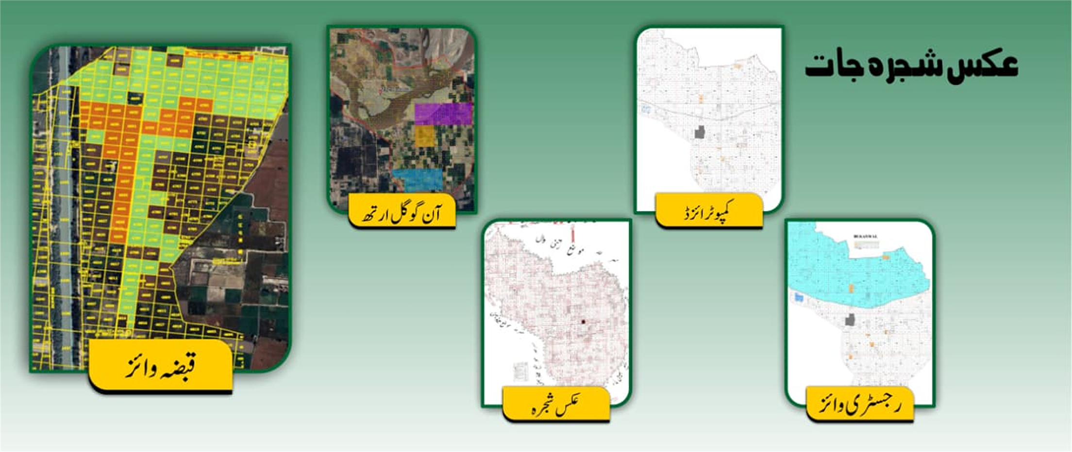
 available02
Mapping & GIS
Land Mgmt · Geo Tagging · CAD
Aks Shajra JaatAvailable
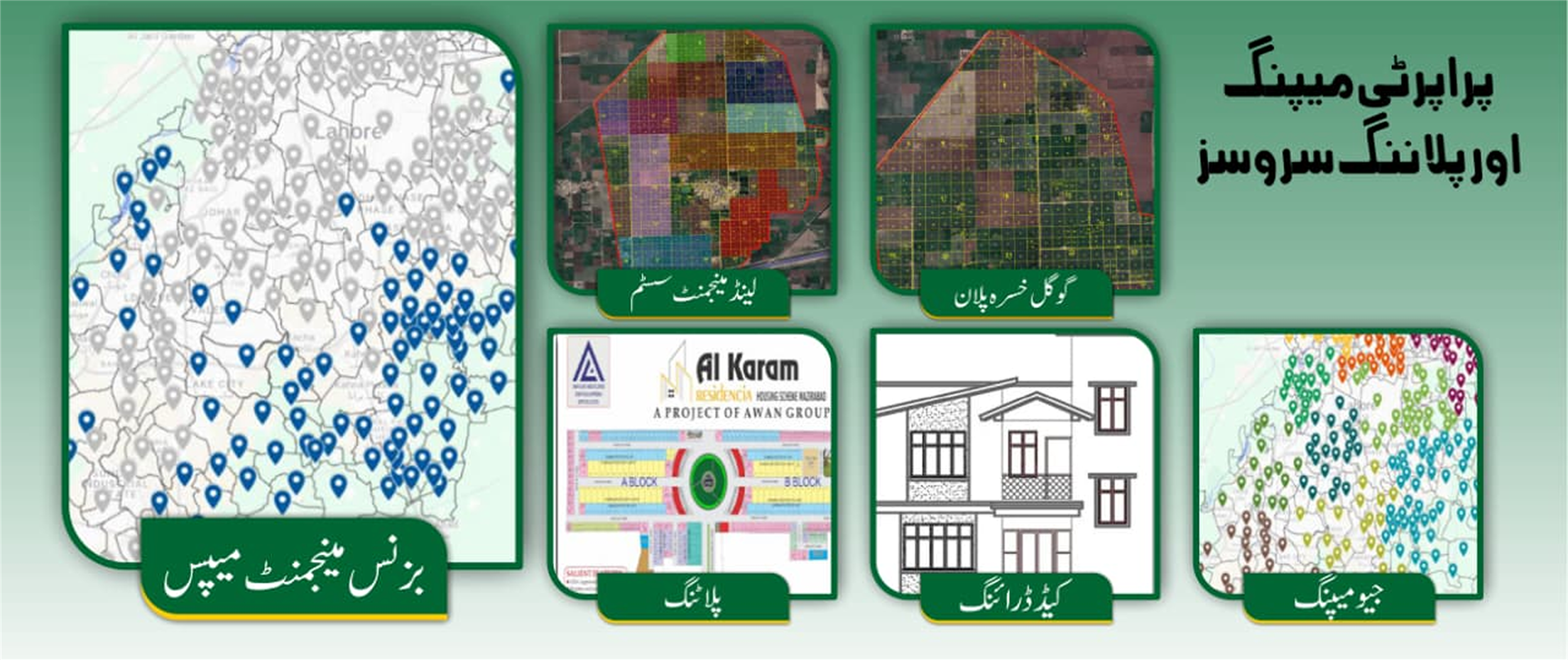
Geo-referenced property maps overlaid on satellite imagery — covering land management systems, Google Khasra plans, business management maps and geo-tagging for precise boundary identification and plot verification.
 khasra plan03
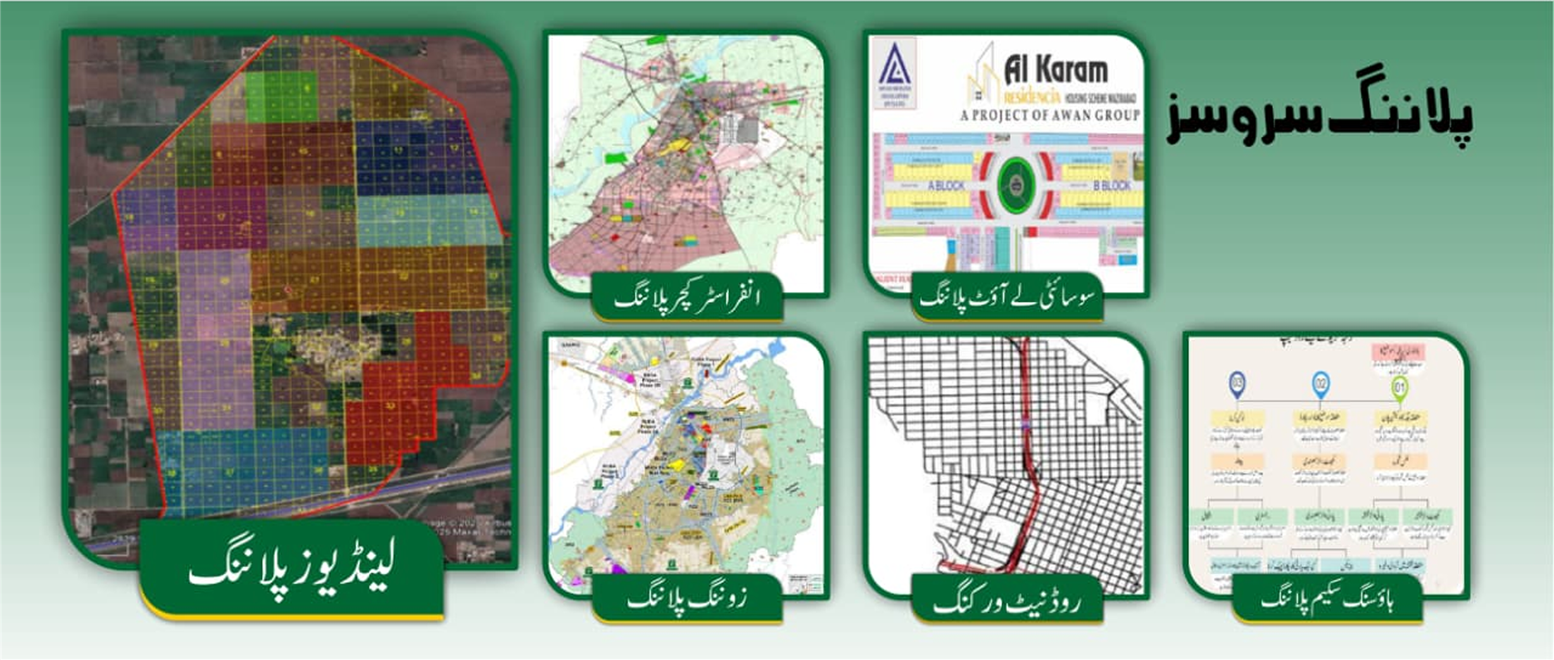
Land Use Planning
Infrastructure · Zoning · Housing
Digitization ofKhasra Plan
Full-spectrum land use planning from infrastructure and zoning to society layout, road network design and complete housing scheme documentation — submitted and approved across Punjab's planning authorities.
 Google Earth Mapping04
Google Earth Mapping
Mutation · Fard · Drafting
Google EarthMapping
End-to-end property legal services including mutation processing, fard issuance, legal drafting and full compliance support — handled by experienced professionals across all Punjab tehsil and registry offices.
 GIS & Technology05
GIS & Technology
Satellite · Geo Tag · Business GIS
GISSolutions
Satellite-linked geo-tagging and multi-layer GIS mapping for precise land intelligence — business management maps, ownership overlays and investment-grade spatial analysis for developers, investors and estate agents.
Free Download
Smart Land Services — Full Brochure
All five services, pricing tiers, sample maps & legal document templates.